
Flying video, taking off from Greensboro's new runway, 5L.
Showing posts with label GSO. Show all posts
Showing posts with label GSO. Show all posts
Thursday, January 27, 2011
Saturday, January 22, 2011
Checking out the new runway at Greensboro (GSO), or as many refer to it, Piedmont Triad International
First post in a few months, been BUSY.
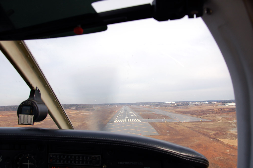
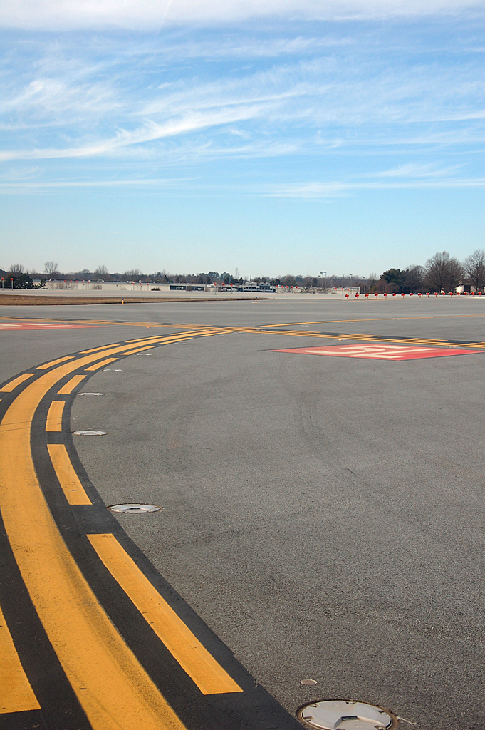
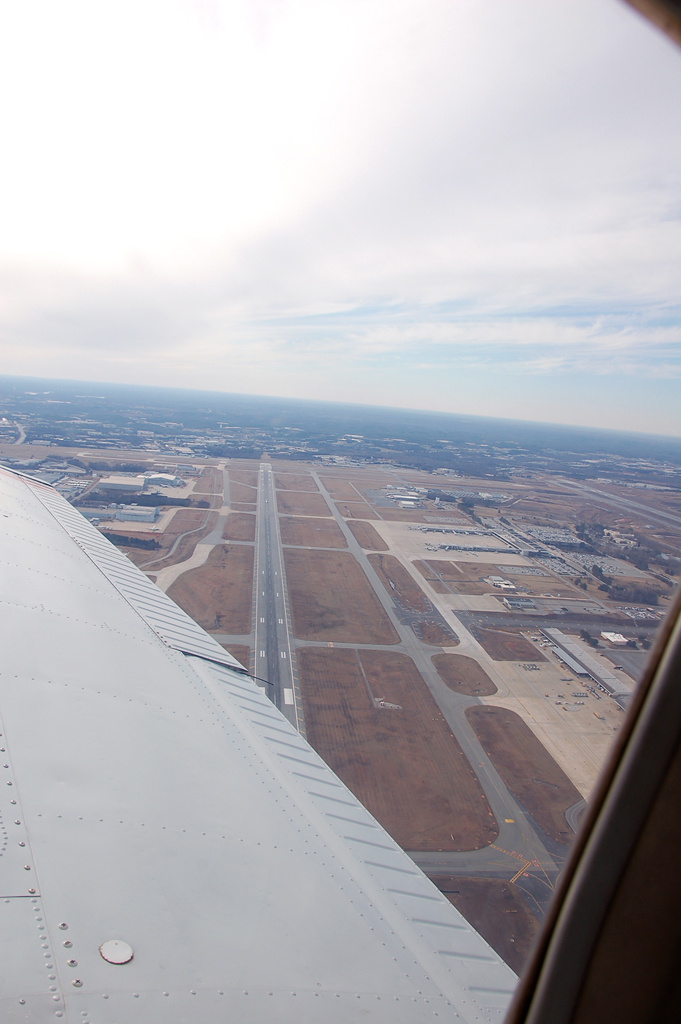
Emily and I flew up to Greensboro today for a short cross-country to land on an almost new runway. The runway was built in tandem with the opening of a new FedEx hub at the airport. It is 9000' x 150' of awesomeness. The weather was nice, cloudy up around 9-10,000 feet, cold, weak wind gusts, smooth above 2500', and good visibility (about 30-40 miles I'd say). Pictures are below of 1) short final into the runway, 2) holding short for takeoff back to TTA and 3) a view of the airport as we leave the area. In the last picture you can see an RJ sitting rolling out from landing on runway 5R. Check out the video of the takeoff here. Pretty cool.


Emily and I flew up to Greensboro today for a short cross-country to land on an almost new runway. The runway was built in tandem with the opening of a new FedEx hub at the airport. It is 9000' x 150' of awesomeness. The weather was nice, cloudy up around 9-10,000 feet, cold, weak wind gusts, smooth above 2500', and good visibility (about 30-40 miles I'd say). Pictures are below of 1) short final into the runway, 2) holding short for takeoff back to TTA and 3) a view of the airport as we leave the area. In the last picture you can see an RJ sitting rolling out from landing on runway 5R. Check out the video of the takeoff here. Pretty cool.


Tuesday, February 2, 2010
Raleigh Executive Jetport (TTA) to Lumberton Municipal Airport (LBT)
The original plan was to fly to Greensboro to get a few pictures of the new runway, but the weather was not cooperating. There were low clouds west of Sanford, and as a non-instrument rated pilot, I have to be able to see the ground and navigate by reference to it alone. Sure I can use the GPS and other nav radios, but my primary source of navigation still has to be reference to objects on the ground.
The skies to the eastern side of TTA were clear. Lumberton seemed to be a good choice, no clouds between TTA and there, and a good route that took us over Fayetteville. I dialed in a new setting on the camera that morning in hopes of getting sharper images and thought Fayetteville would provide some good photo ops. I think it worked.

I planned the flight at the last minute. We did this one a couple of years ago so the flight plan itself was already done. I just had to get the weather and apply the winds to our flight plan. Interesting side note… while I was on the phone with the weather briefer he mentioned that the briefer next to him was talking about a large fire in New York City. I actually forgot about that until right now, but haven't heard anything so it must not have been a big deal.
It was morning and an AIRMET had been established, but was expiring at 10am local. To those of you who don't know what an AIRMET is, it stands for "Airmen's Meteorological Information". Basically, it's an advisory/description of the occurrence or expected occurrence of some sort of weather phenomena which may affect the safety of aircraft operations (yeah, I stole that from wikipedia). AIRMETs give info on instrument conditions (ceilings less than 1000' and/or visibility less than 3 miles), turbulence, or icing. All things for me to avoid.
We had the plane until noon, and had about 50 miles to go and back, so we were pushing it on time. We started up, taxied to runway 3, and off we went. We made left traffic, but continued climbing through pattern altitude of 1200' MSL. Upon reaching 1700' MSL (500' above pattern altitude) we turned south toward Fayetteville. Direct flight to Lumberton is not allowed because of the restricted areas above Fort Bragg. Our course took us towards the lesser known of the two air bases in Fayetteville, Simmons Army Airfield.

From here we turned slightly toward the west and pretty much followed I-95 all the way to Lumberton. In the distance we could see where it all began for me, the Laurinburg-Maxton Airport (MEB). It was about 20-25 miles away. It's always satisfying to me to see something that clearly from that far away.
From about 12 miles out we could easily make out LBT in front of us. Up until this point I had been on with Fayetteville Approach for traffic advisories. Once LBT was visible, I let them know and they cleared me to change to the airport's local radio frequency. We executed a standard pattern entry to runway 5 and had a nice landing on a really flat runway.

Because of our lack of time we taxied straight back to the runway and took back off. I wanted some good pics of the airport, and the sun was to the southeast, so I turned east and then south after taking off so we could get a good view of the airport with the sun behind us before heading back home to the north. Emily takes great pictures.

We got back in touch with Fayetteville Approach for traffic advisories. The trip back was a lot like the trip down. The weather was fantastic for flying, clear and smooth air. On the way back over Fayetteville we got a good view of the Fayetteville Regional Airport (FAY) off the right wing.

Minutes later we were flying over Fort Bragg with Pope AFB (POB) in the background. The controller said that the restricted airspace over Fort Bragg was inactive at my altitude, which I'm assuming means I could have flown right through. I stuck with the original plan and flew around, but I did get a little closer to Pope than I usually do. It was pretty cool.

Coming back into TTA there was only one other plane on the radio who was doing an instrument approach to runway 3. He was in a faster plane than me so I gave way to him. To enter the pattern I had to overfly the field at 1700', then loop around and descend at the same time 1200' to enter the left downwind for runway 3. We landed at 11:56 (4 minutes to spare!). Great trip, it was fun.
The skies to the eastern side of TTA were clear. Lumberton seemed to be a good choice, no clouds between TTA and there, and a good route that took us over Fayetteville. I dialed in a new setting on the camera that morning in hopes of getting sharper images and thought Fayetteville would provide some good photo ops. I think it worked.

Our route
I planned the flight at the last minute. We did this one a couple of years ago so the flight plan itself was already done. I just had to get the weather and apply the winds to our flight plan. Interesting side note… while I was on the phone with the weather briefer he mentioned that the briefer next to him was talking about a large fire in New York City. I actually forgot about that until right now, but haven't heard anything so it must not have been a big deal.
It was morning and an AIRMET had been established, but was expiring at 10am local. To those of you who don't know what an AIRMET is, it stands for "Airmen's Meteorological Information". Basically, it's an advisory/description of the occurrence or expected occurrence of some sort of weather phenomena which may affect the safety of aircraft operations (yeah, I stole that from wikipedia). AIRMETs give info on instrument conditions (ceilings less than 1000' and/or visibility less than 3 miles), turbulence, or icing. All things for me to avoid.
We had the plane until noon, and had about 50 miles to go and back, so we were pushing it on time. We started up, taxied to runway 3, and off we went. We made left traffic, but continued climbing through pattern altitude of 1200' MSL. Upon reaching 1700' MSL (500' above pattern altitude) we turned south toward Fayetteville. Direct flight to Lumberton is not allowed because of the restricted areas above Fort Bragg. Our course took us towards the lesser known of the two air bases in Fayetteville, Simmons Army Airfield.

Simmons AFB in Fayetteville. If you look closely almost in the middle of the ramp
closest to the camera you can see a helicopter hovering about 50' off the ground.
closest to the camera you can see a helicopter hovering about 50' off the ground.
From here we turned slightly toward the west and pretty much followed I-95 all the way to Lumberton. In the distance we could see where it all began for me, the Laurinburg-Maxton Airport (MEB). It was about 20-25 miles away. It's always satisfying to me to see something that clearly from that far away.
From about 12 miles out we could easily make out LBT in front of us. Up until this point I had been on with Fayetteville Approach for traffic advisories. Once LBT was visible, I let them know and they cleared me to change to the airport's local radio frequency. We executed a standard pattern entry to runway 5 and had a nice landing on a really flat runway.

Short final to runway 5, LBT
Because of our lack of time we taxied straight back to the runway and took back off. I wanted some good pics of the airport, and the sun was to the southeast, so I turned east and then south after taking off so we could get a good view of the airport with the sun behind us before heading back home to the north. Emily takes great pictures.

Lumberton Municipal Airport - Runway 5 is the one on the far left with the big "5" on it.
I-95 is the highway on the other side of the airport. If you've ever driven down that way
you may recognize the big water tower painted like an American flag directly
above the wing out by the highway.
I-95 is the highway on the other side of the airport. If you've ever driven down that way
you may recognize the big water tower painted like an American flag directly
above the wing out by the highway.
We got back in touch with Fayetteville Approach for traffic advisories. The trip back was a lot like the trip down. The weather was fantastic for flying, clear and smooth air. On the way back over Fayetteville we got a good view of the Fayetteville Regional Airport (FAY) off the right wing.

Fayetteville Regional Airport
Minutes later we were flying over Fort Bragg with Pope AFB (POB) in the background. The controller said that the restricted airspace over Fort Bragg was inactive at my altitude, which I'm assuming means I could have flown right through. I stuck with the original plan and flew around, but I did get a little closer to Pope than I usually do. It was pretty cool.

Fort Bragg with Pope AFB
Coming back into TTA there was only one other plane on the radio who was doing an instrument approach to runway 3. He was in a faster plane than me so I gave way to him. To enter the pattern I had to overfly the field at 1700', then loop around and descend at the same time 1200' to enter the left downwind for runway 3. We landed at 11:56 (4 minutes to spare!). Great trip, it was fun.
Tuesday, January 19, 2010
New Runway at Piedmont Triad International (GSO)
Emily and I were riding through Greensboro a few weeks ago. I've been meaning to ride by to see the new runway at GSO, and this was a good opportunity. We took some pictures, although it's hard to see the runway from the low angles we were able to see it from. Once it opens I'll fly up there and request to land on the new runway to get some better pictures.
The runway is being constructed because of the new FedEx hub that has been built at GSO. This should make for some pretty amazing plane watching, as FedEx uses big planes (A310s and MD-11s, among others). As a hub, they'll be coming in and out frequently. With that and the Honda Jet factory based on the field, GSO is really emerging as quite the contributor to the aviation industry in NC. Pictures Below...


The runway is being constructed because of the new FedEx hub that has been built at GSO. This should make for some pretty amazing plane watching, as FedEx uses big planes (A310s and MD-11s, among others). As a hub, they'll be coming in and out frequently. With that and the Honda Jet factory based on the field, GSO is really emerging as quite the contributor to the aviation industry in NC. Pictures Below...

Kind of hard to see, but here is new runway 23R at GSO

Freshly built FedEx hub. This will make GSO a good plane watching airport.
Subscribe to:
Posts (Atom)


