First post in a few months, been BUSY.
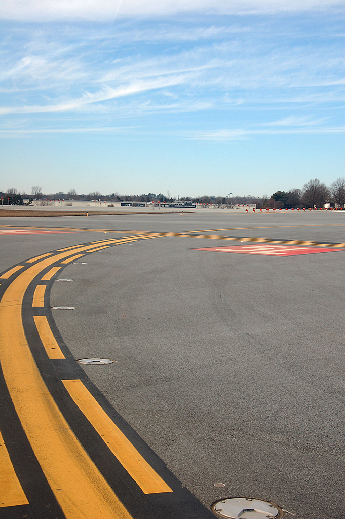
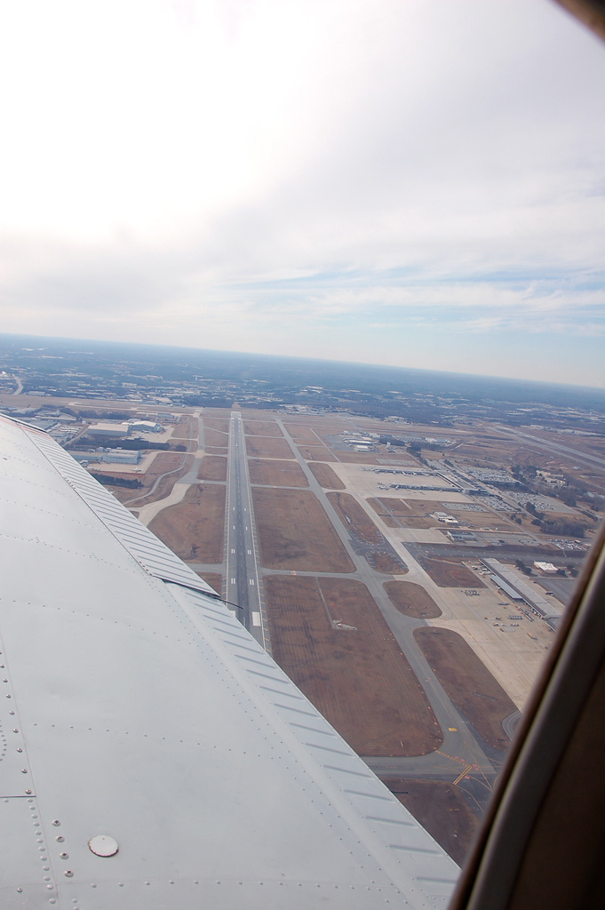
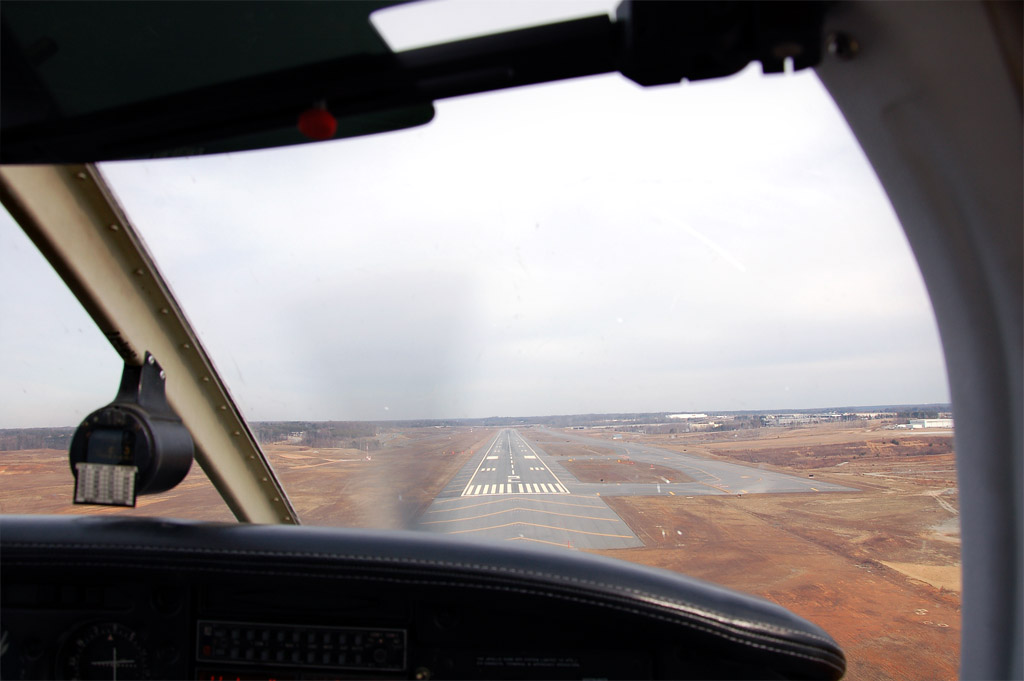
Emily and I flew up to Greensboro today for a short cross-country to land on an almost new runway. The runway was built in tandem with the opening of a new FedEx hub at the airport. It is 9000' x 150' of awesomeness. The weather was nice, cloudy up around 9-10,000 feet, cold, weak wind gusts, smooth above 2500', and good visibility (about 30-40 miles I'd say). Pictures are below of 1) short final into the runway, 2) holding short for takeoff back to TTA and 3) a view of the airport as we leave the area. In the last picture you can see an RJ sitting rolling out from landing on runway 5R. Check out the video of the takeoff here. Pretty cool.
Showing posts with label Pictures. Show all posts
Saturday, January 22, 2011
Tuesday, October 5, 2010
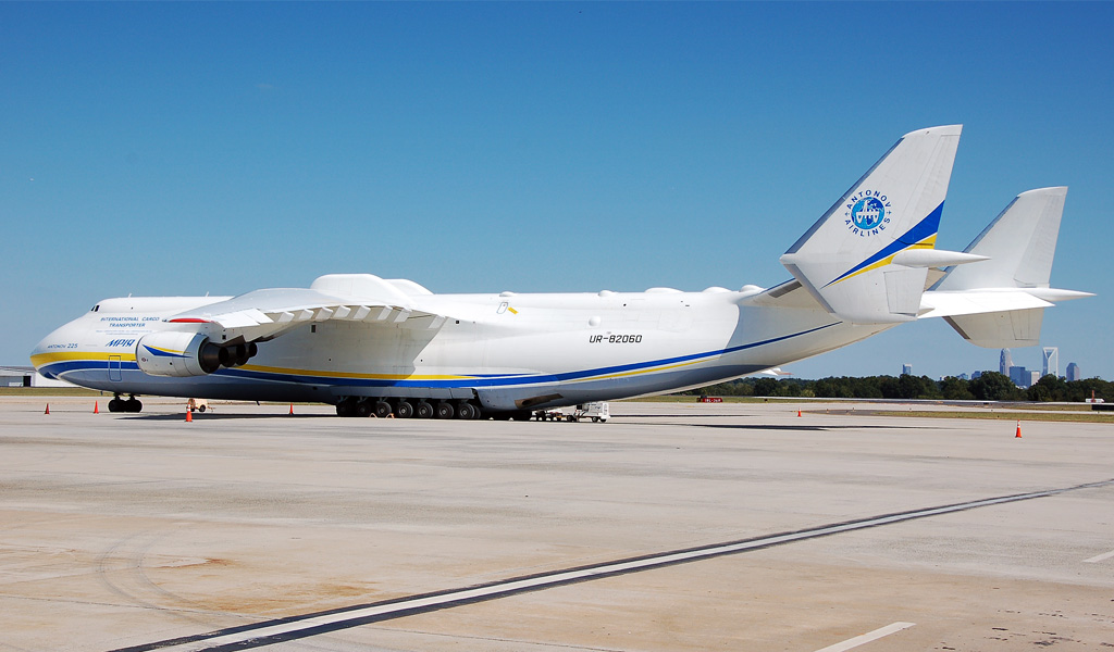
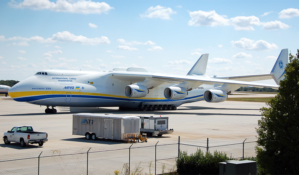
World's largest airplane, Antonov 225, at Charlotte (CLT)
Emily and I were in Charlotte this past weekend for a wedding. In normal style we went to the airport to watch some plane action. Saturday wasn't very busy so we decided to head back to the hotel to get ready for the wedding a little early. On the road around the southern end of the airport I spotted the double tail of the AN-225, otherwise known as the largest airplane in the world. Originally built to carry the Russian space shuttle on it's back, it is now used to carry very large cargo loads around the world. It has a maximum takeoff weight of about 1.32 million pounds, which is 50% heavier than a fully loaded C-5A (according to this article).
I was able to go out a couple of years ago when it made an appearance at RDU and watched it takeoff at about midnight in the rain. Below are a couple of pictures I took of it while it was sitting on the cargo ramp at CLT. I've also included a video of it taking off from runway 36C at CLT yesterday. Too bad I wasn't there to watch it take off.
Labels:
Airliner,
CLT,
Pictures,
Plane Watching
Sunday, September 5, 2010
Flying for Jerky
There's a beef jerky outlet in Concord, NC. Naturally, that's a reason to fly somewhere. The Concord Regional Airport (JQF) is about 80 nautical miles WSW from Raleigh Executive (TTA). Why I've never flown there in my 4 years as a licensed pilot I do not know. The best I can come up with is that I was reluctant to get that close to the busy airport in Charlotte which, according to our trustworthy friends at Wikipedia is now on the list of top 10 busiest airports in the U.S. That's kind of intimidating. One of these days I'll go 16 miles past today's destination and make my presence known at the #10 busiest airport in the country.
Jerky is not the only reason to fly into Concord as it's solid cross-country time from Raleigh Exec. A little further than the minimum 50 miles, but not so far that it becomes crazy expensive. Total flight time was 2 hours even. I got to hear "Cleared to enter class bravo airspace" for the first time today, so that was exciting.
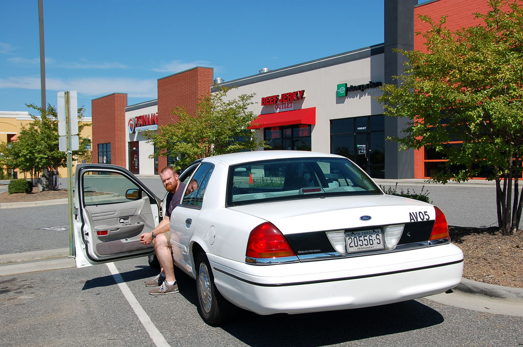
With purchase of fuel at the FBO we were allowed to borrow a sweet Crown Victoria crew car with a "permanent" NC plate, just like a real cop. The facilities and people at the FBO were great.
Of course I have pictures taken by copilot Emily.
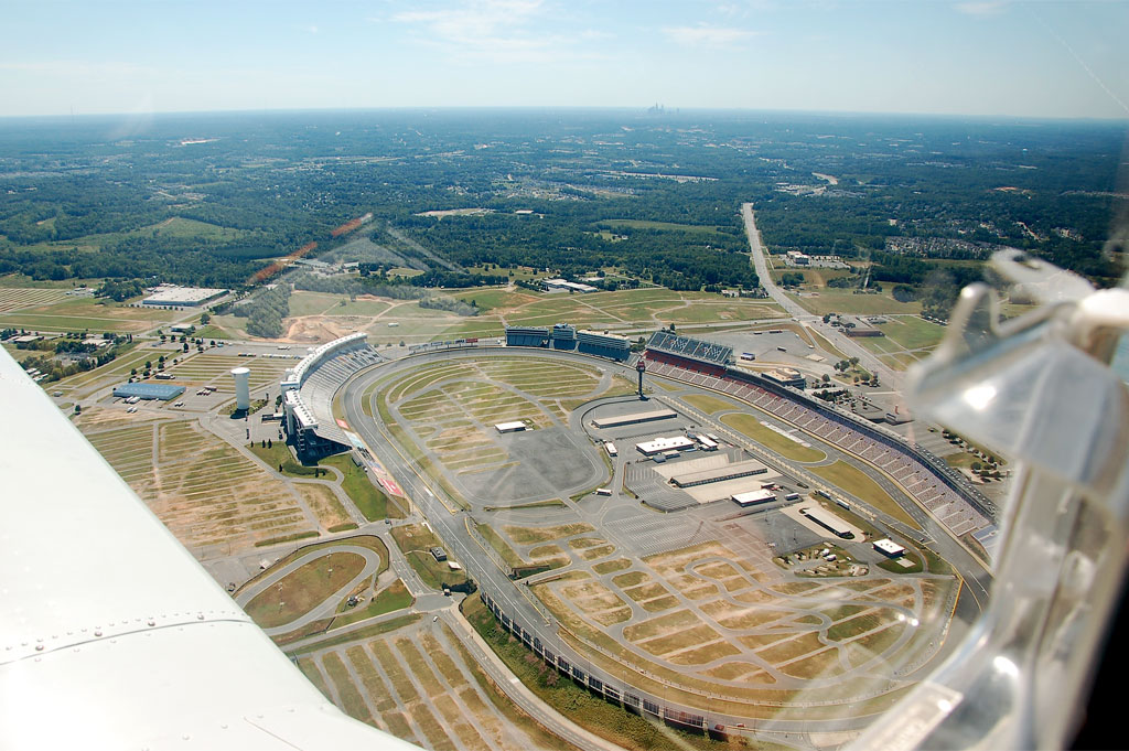
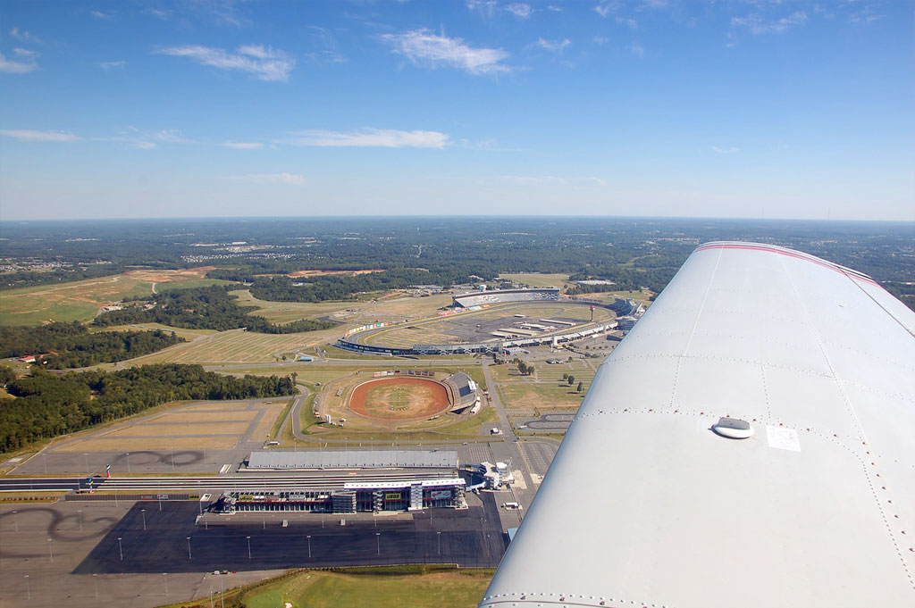
Right base for runway 2 at JQF takes us right over the Lowe's Motor Speedway with the Charlotte skyline in the background.
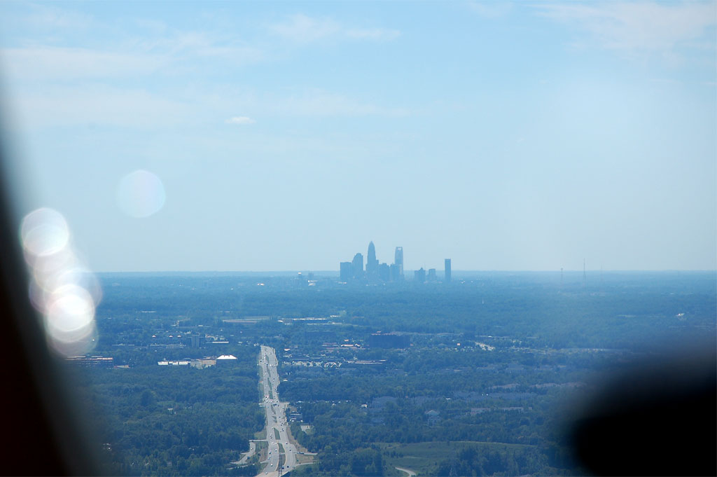
Charlotte skyline from about 10 miles to the NE.
No caption necessary.
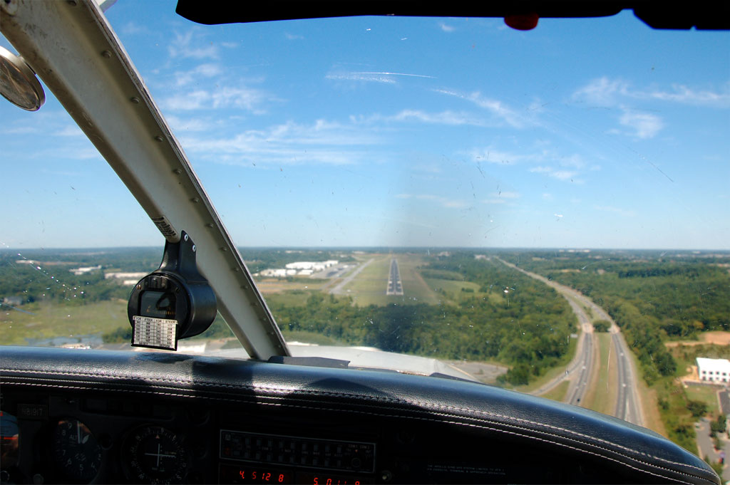
Final approach to runway 2 at JQF. Smooth landing. That's I-85 to the right, looking north.
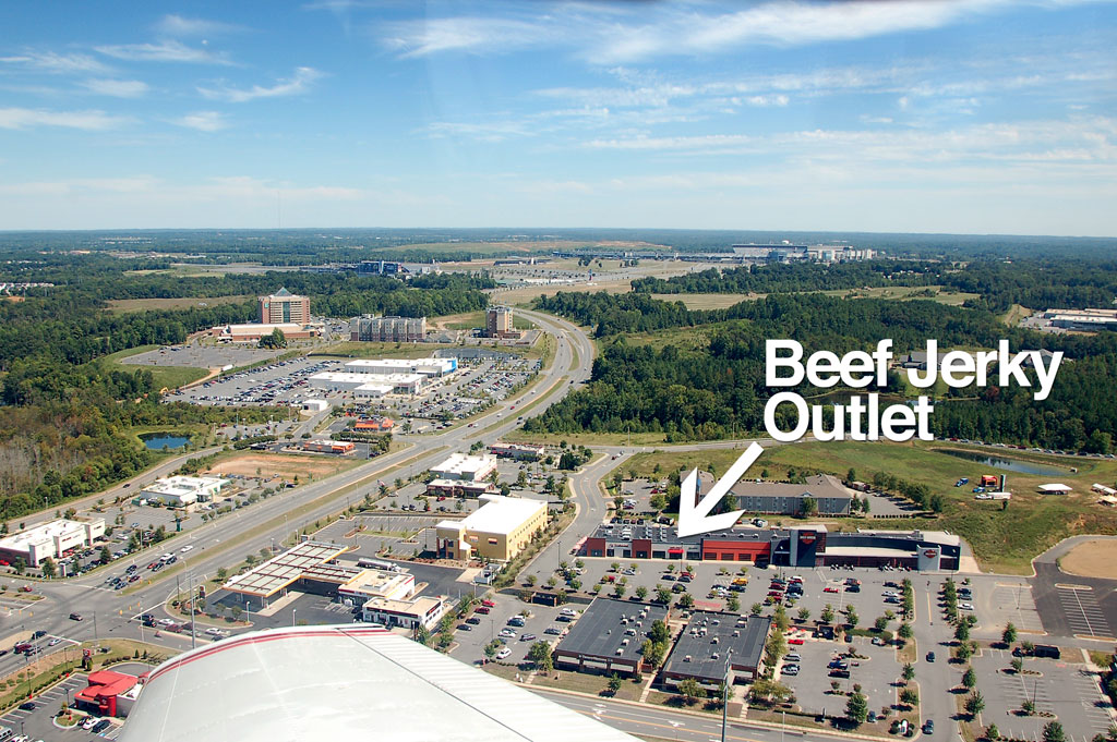
Crew car Crown Vic, looking like a cop, Jerky in the background.
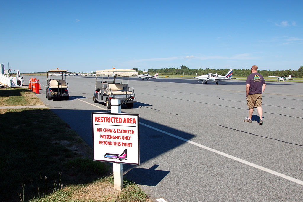
You could refer to me as "air crew". That would make Emily my "escorted passenger".
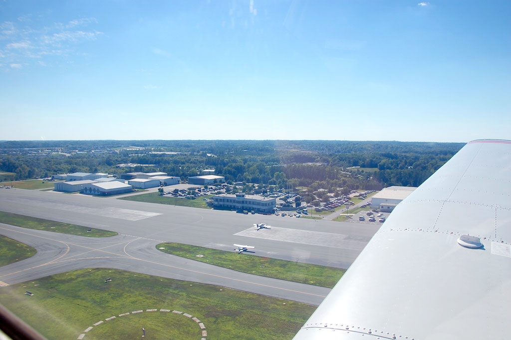
Concord Regional FBO. Great service, friendly folks, nice facilities.
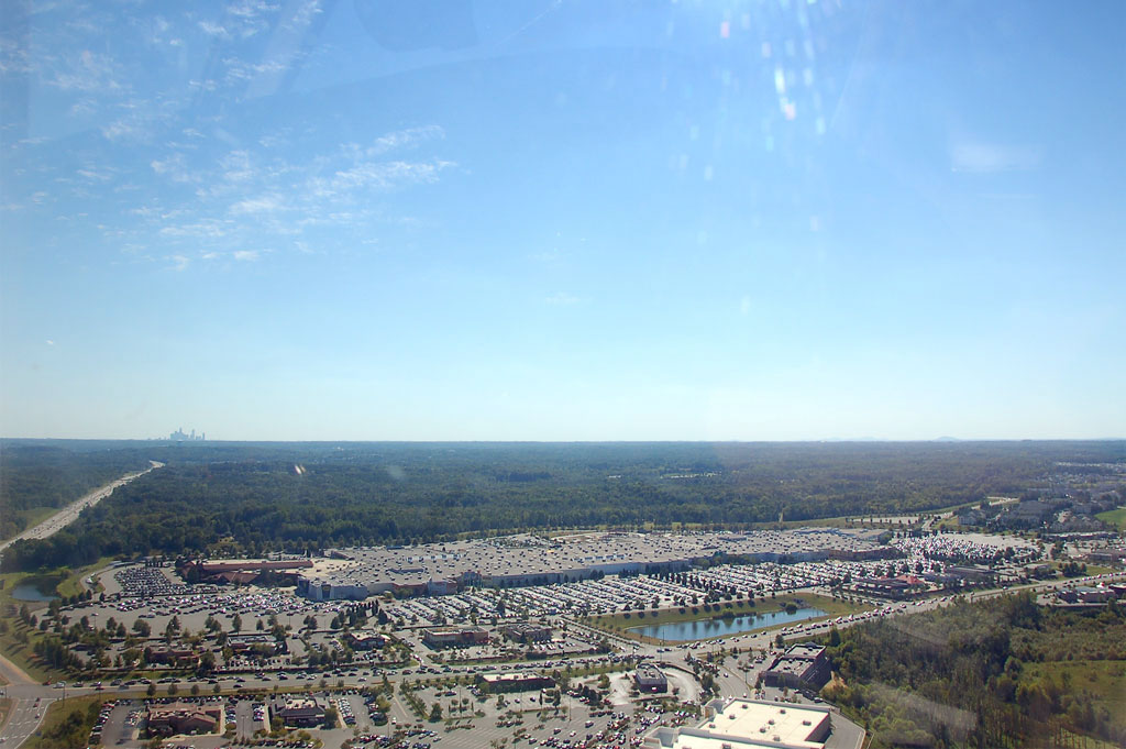
Really busy day at Concord Mills Mall. Lots of cars.
The climb-out from JQF gave us a great view of the Lowe's Motor Speedway, drag strip, and dirt track.
Jerky is not the only reason to fly into Concord as it's solid cross-country time from Raleigh Exec. A little further than the minimum 50 miles, but not so far that it becomes crazy expensive. Total flight time was 2 hours even. I got to hear "Cleared to enter class bravo airspace" for the first time today, so that was exciting.
With purchase of fuel at the FBO we were allowed to borrow a sweet Crown Victoria crew car with a "permanent" NC plate, just like a real cop. The facilities and people at the FBO were great.
Of course I have pictures taken by copilot Emily.
Right base for runway 2 at JQF takes us right over the Lowe's Motor Speedway with the Charlotte skyline in the background.
Charlotte skyline from about 10 miles to the NE.
No caption necessary.
Final approach to runway 2 at JQF. Smooth landing. That's I-85 to the right, looking north.
Crew car Crown Vic, looking like a cop, Jerky in the background.
You could refer to me as "air crew". That would make Emily my "escorted passenger".
Concord Regional FBO. Great service, friendly folks, nice facilities.
Really busy day at Concord Mills Mall. Lots of cars.
The climb-out from JQF gave us a great view of the Lowe's Motor Speedway, drag strip, and dirt track.
Wednesday, July 7, 2010
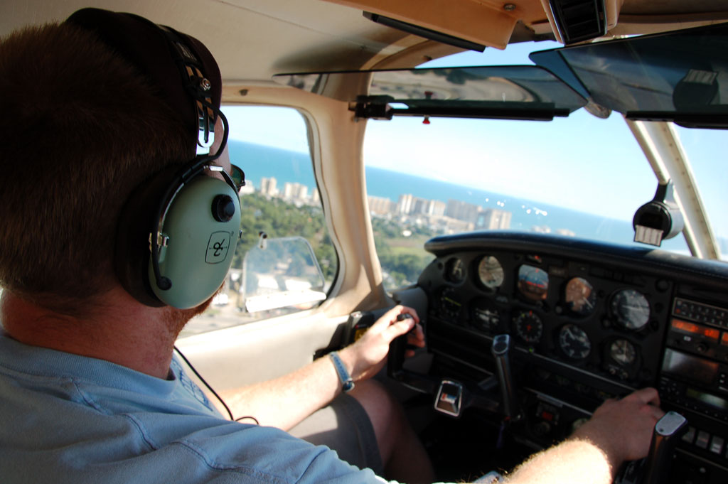
Aerial pictures of North Myrtle Beach
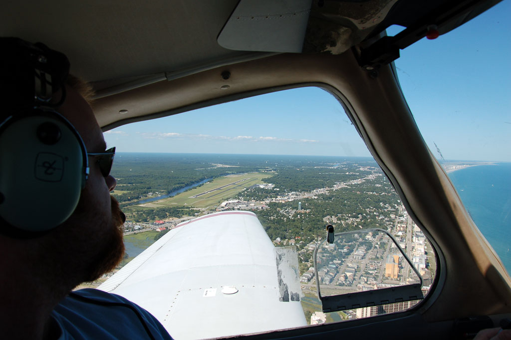
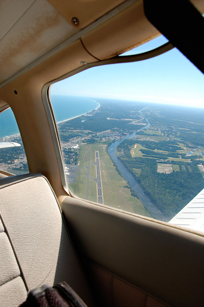
Taking off from the Grand Strand Airport (CRE).
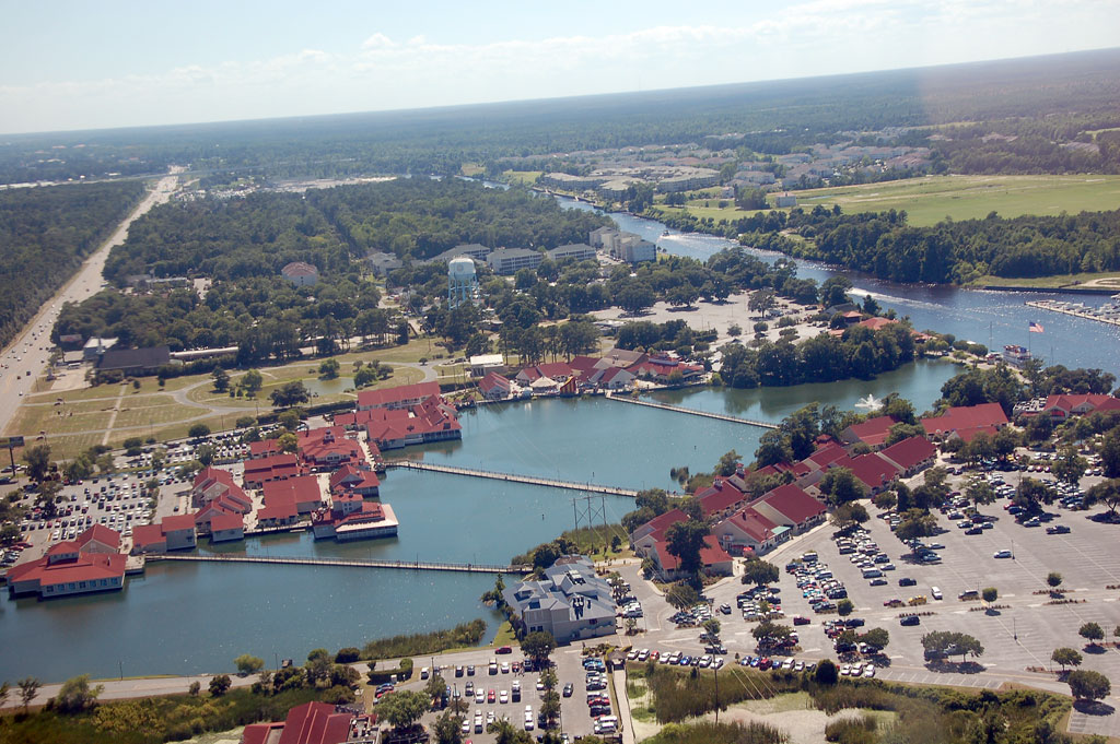
Barefoot Landing.
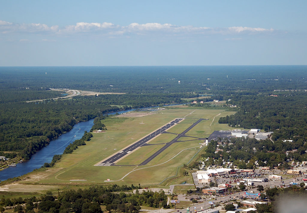
Looking back at the airport.
Turning out over the ocean before heading back to Raleigh Executive (TTA).
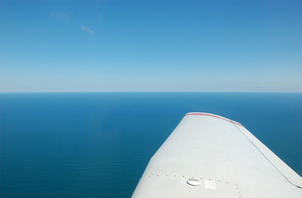
Nothing but water out of the right side of the plane.
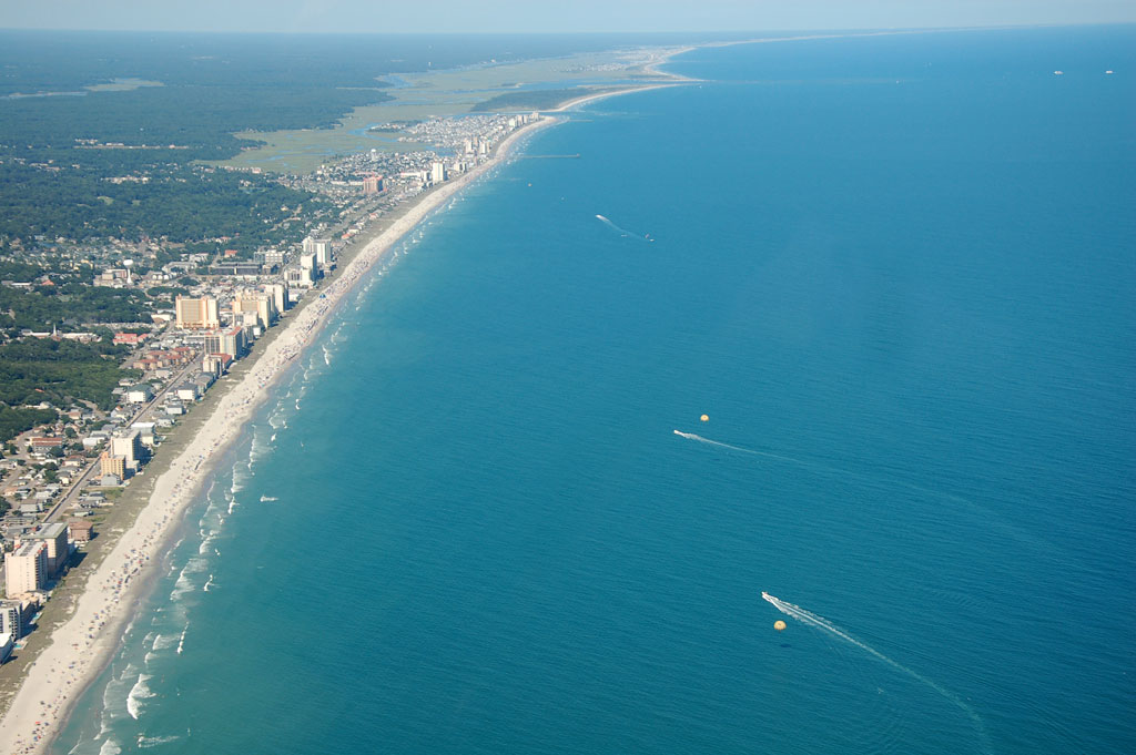
North Myrtle and Cherry Grove. You can see para-sailors.
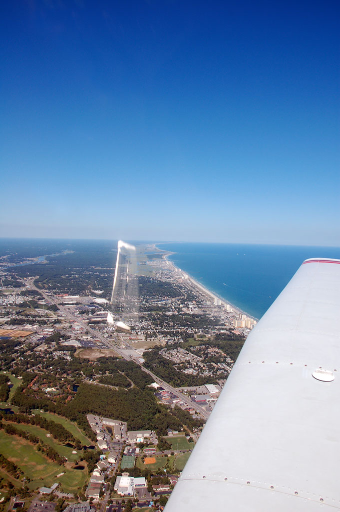
North Myrtle and Cherry Grove, looking north up highway 17.
Looking south back at the airport.
Barefoot Landing.
Looking back at the airport.
Turning out over the ocean before heading back to Raleigh Executive (TTA).
Nothing but water out of the right side of the plane.
North Myrtle and Cherry Grove. You can see para-sailors.
North Myrtle and Cherry Grove, looking north up highway 17.
Looking south back at the airport.
Saturday, July 3, 2010
Airline flying pictures
Had a chance to get some good pictures earlier this week from the plane both going and coming back from NYC. The flight was from RDU to LGA in a CRJ900. The flight to LGA went up to I believe 32,000 feet and took about an hour, the flight coming back cruised at 28,000 feet and took about an hour and fifteen minutes. The weather was great for "big plane" flying.
Shortly after departure from runway 23R at RDU, so over Morrisville, about 6:25am.
Nice picture looking towards the sun with the misty clouds down below.
Same as above.
Our plane for the trip to NYC, CRJ900. We flew on the same thing back to RDU.
Shorty after departure from runway 4 at LGA, we made a left turn towards the northern part of Newark. This is a picture of the Hudson River looking south, Manhattan Island on the left, New Jersey on the right. The USAirways flight that crashed in the Hudson went down about 6-7 miles past the bridge you can see going over the river.
Somewhere over the northern Virginia on a beautiful day. I love how dark the sky gets at higher altitudes.
Falls lake with a small grass strip just north of Durham. The highway you see is I-85.
On the downwind to runway 5L at RDU. Good view looking east of the interchange where NC-147 (Durham Freeway) dumps out onto I-40.
Shortly after departure from runway 23R at RDU, so over Morrisville, about 6:25am.
Nice picture looking towards the sun with the misty clouds down below.
Same as above.
Our plane for the trip to NYC, CRJ900. We flew on the same thing back to RDU.
Shorty after departure from runway 4 at LGA, we made a left turn towards the northern part of Newark. This is a picture of the Hudson River looking south, Manhattan Island on the left, New Jersey on the right. The USAirways flight that crashed in the Hudson went down about 6-7 miles past the bridge you can see going over the river.
Somewhere over the northern Virginia on a beautiful day. I love how dark the sky gets at higher altitudes.
Falls lake with a small grass strip just north of Durham. The highway you see is I-85.
On the downwind to runway 5L at RDU. Good view looking east of the interchange where NC-147 (Durham Freeway) dumps out onto I-40.
Friday, June 25, 2010
Flying to La Guardia tomorrow
The wife's family is heading to NYC tomorrow for a long weekend. Our flight leaves RDU at 6:15am and is due to arrive at La Guardia (LGA) a little before 8am. Here's a few good pictures of LGA, all from Airliners.net. I'll have pictures/videos of our actual flight next week sometime.
Friday, June 18, 2010
Flying Pictures
Just some more random flying pictures. The pictures show:
1. Flying over Raleigh, a good view of the RBC Center, Carter Finley Stadium, and the NC State Fair Grounds. Right in front of the wingtip you can see a little bit of the clearing around RDU.
2. Kenan Stadium and Carmichael Gym (where Michael Jordan used to tear it up) a couple of years ago.
3. Durham Bulls Athletic Park (DBAP) and the American Tobacco District, a couple of years ago. You can see the construction of the Durham Performing Arts Center on the right.
4. Seeing the clouds with their own shadows gives some cool perspective... at least for me.
1. Flying over Raleigh, a good view of the RBC Center, Carter Finley Stadium, and the NC State Fair Grounds. Right in front of the wingtip you can see a little bit of the clearing around RDU.
2. Kenan Stadium and Carmichael Gym (where Michael Jordan used to tear it up) a couple of years ago.
3. Durham Bulls Athletic Park (DBAP) and the American Tobacco District, a couple of years ago. You can see the construction of the Durham Performing Arts Center on the right.
4. Seeing the clouds with their own shadows gives some cool perspective... at least for me.
Sunday, June 13, 2010
Raleigh Executive to Halifax-Northampton Regional Airport
I was finally able to get my brother up in the plane on Friday after a few months of rain-outs and low-ceilings. I got off work a couple of hours early and drove down to Sanford to get ready while my brother drove up from down south. The plan was to go to Halifax-Northampton Regional Airport (IXA), which opened last year just south of Roanoke Rapids, NC. It was about 84 miles one way, and the flight path took us directly over downtown Raleigh.
The weather was very hot, about 91 degrees. There was a convective sigmet (basically big and powerful thunderstorms) about 100 miles to the west. I was a little concerned by it, but felt confident that the weather would be no factor for us.
Crawling around on the hot pavement during pre-flight checking the wheels and the underside of the plane was brutal. I was in a rush to get the plane started so we could have some air movement while we were on the ground.
Even though it was hot the air was surprisingly smooth and pretty hazy. There were scattered clouds about 5,500', so I decided to level off at 3,500 for the first half of the flight. It wasn't as high as I would like to have been, but good enough. We had a great view of Cary and Raleigh on the way up and got some great pictures. I always enjoy flying over familiar places. Here's a picture of Carter-Finley Stadium and the RBC Center.
As we approached IXA there was only one other plane taking off. They headed off in the opposite direction from us so no big deal. We made left traffic for runway 20 and greased the landing. A picture of the final approach to IXA is below.
The FBO was already closed for the night so we just taxied back to the runway and took back off to the southwest back to TTA. The plan was to climb to 4,500' for cruise. About 4,000 I started to notice the apparent lack of visibility, and realized that I was arguably in a VERY thin cloud that really couldn't be seen, but did cause a pretty quick decrease in visibility. I immediately descended back down to 3,500' to avoid going out of VFR conditions.
The flight back was somewhat uneventful. We went back over downtown Raleigh and NC State University just like before and made our way down US-1 to TTA. There were several other planes in the pattern, but we fit right into the left downwind for runway 3 and made another very smooth landing. The ride was pretty much bump free. They call that ego flying because it makes you feel like you're really good (even though I know better).
The photos below are 1) looking south down Fayetteville Street in downtown Raleigh, 2) NC State's campus, 3) pretty cloud picture, and 4) final approach to runway 3 at TTA.
The weather was very hot, about 91 degrees. There was a convective sigmet (basically big and powerful thunderstorms) about 100 miles to the west. I was a little concerned by it, but felt confident that the weather would be no factor for us.
Crawling around on the hot pavement during pre-flight checking the wheels and the underside of the plane was brutal. I was in a rush to get the plane started so we could have some air movement while we were on the ground.
Even though it was hot the air was surprisingly smooth and pretty hazy. There were scattered clouds about 5,500', so I decided to level off at 3,500 for the first half of the flight. It wasn't as high as I would like to have been, but good enough. We had a great view of Cary and Raleigh on the way up and got some great pictures. I always enjoy flying over familiar places. Here's a picture of Carter-Finley Stadium and the RBC Center.
As we approached IXA there was only one other plane taking off. They headed off in the opposite direction from us so no big deal. We made left traffic for runway 20 and greased the landing. A picture of the final approach to IXA is below.
The FBO was already closed for the night so we just taxied back to the runway and took back off to the southwest back to TTA. The plan was to climb to 4,500' for cruise. About 4,000 I started to notice the apparent lack of visibility, and realized that I was arguably in a VERY thin cloud that really couldn't be seen, but did cause a pretty quick decrease in visibility. I immediately descended back down to 3,500' to avoid going out of VFR conditions.
The flight back was somewhat uneventful. We went back over downtown Raleigh and NC State University just like before and made our way down US-1 to TTA. There were several other planes in the pattern, but we fit right into the left downwind for runway 3 and made another very smooth landing. The ride was pretty much bump free. They call that ego flying because it makes you feel like you're really good (even though I know better).
The photos below are 1) looking south down Fayetteville Street in downtown Raleigh, 2) NC State's campus, 3) pretty cloud picture, and 4) final approach to runway 3 at TTA.
Labels:
Cross Country,
Flight,
Flying,
IXA,
PA28,
Pictures,
TTA,
Wings of Carolina Flying Club
Thursday, May 13, 2010
New flying pictures uploaded
Well, not new, but newly uploaded. Just a few pics from my trip with Emily to the Grand Strand Airport in North Myrtle Beach in October 2008. View more on my Flickr page.
Friday, April 23, 2010
Flying Picture of the day/week/month/whatever
Awesome weather picture taken somewhere between Dallas/Fort Worth (DFW) and Fort Lauderdale (FLL). That's one heck of an office view. Original image location at Airliners.net.
Wednesday, March 31, 2010
Flight from Raleigh Executive to MCAS Cherry Point (yeah, that's right)
Thanks to the forethought and planning of one of my fellow Wings of Carolina Flying Club members, I recently was able to fly into MCAS (Marine Corps Air Station) Cherry Point (NKT). About 8 planes from our club took the 116 mile trip from Raleigh Executive (TTA). It was a really nice day.
The weather was beautiful, in the mid 60's and crystal clear. There was a bit of gusty wind, but up at 5,500' it was as smooth as glass.
I was cleared to land on runway 32L using a base to very short final so I could sneak in before another club member, who was in a Cessna 152 on a 6 mile final. I felt I was getting a bit short-changed on this approach so I requested to follow the Cessna on final in, which the controller kindly allowed.
The runway from edge-line to edge-line is 200' wide with an extra 100' beyond that, making for a 400' wide strip of pavement that is about 8,000' long; big strip of concrete. The excessive width made the gusting cross-wind a little less of a problem than it would have been on, let's say, a 75' wide runway. Long story short, the landing was pretty darn good (if I do say so myself). We were given taxi instructions to our parking spot, shut down, and got out. Clearance to land required a VFR flight plan, so I had to call Flight Service to close that.
The first stop of the tour was a hanger that housed a Cessna Citation and two military equivalents of a DC-9. All three of these were for the travel of Marine higher-ups. We got to go inside one of the DC-9s, but the pictures didn't turn out so well (that's why they aren't included here, sorry). Also in the hanger were two search and rescue helicopters. I didn't catch the exact model, but take a look at the picture. They were pretty awesome.
After the hanger we were treated with an up-close and personal view of the Harrier Jet line. They had quite a few two-seaters for training. Our tour guide was a Harrier student pilot, and had a lot of interesting info. I won't go into any details here, but we learned a lot and left much more impressed with the plane than when we got there. During our tour there were 3-4 Harriers flying around the base doing some training.
From here we went to eat lunch at a restaurant on the base. I was about to starve. It was good, not great. Our tax money at work.
One of the highlights of the day was the opportunity to see the air traffic control facilities. I got to visit the inside of a control tower for the first time. It was similar to what I expected except for the people in there. I was expecting some older, seasoned-looking controllers (like what you see on Top Gun). I get up there and there are about 10 really young looking guys -- yes, younger than me -- half of them training and the other half being trained. Because it was Saturday they were all dressed in their street clothes, making it all seem a little less impressive. Notice I said "seem", it was still all business. It was great to see everything from their perspective.
From the top of the base to the bottom, we found ourselves next in the radar room. Radar rooms, to those of you who don't know, are really dark. My eyes adjusted to the low red light, but I couldn't imagine working in there for several hours without going a little crazy. Beyond that, it was still very cool to see the radar screens, have the controllers explain what they do and, again, see it from their perspective.
The surprise of the day was when the Marines asked if they could come see our planes. We scoffed, "sure, yeah right, you can come look at our planes." To our surprise, they were actually very eager to see them. It dawned on me that most of these guys probably have never seen planes up-close other than Harriers and other cool military planes. A Piper Warrior is a new thing to them. It was pretty cool.
So all in all it was a great trip. I got to land at a military base, saw some planes up close that I've never seen up close before, saw air traffic control, and got to fly the longest flight of my "career"; yes, 116 miles. It was a great time.
The weather was beautiful, in the mid 60's and crystal clear. There was a bit of gusty wind, but up at 5,500' it was as smooth as glass.
The view looking east-ish towards Beaufort and Cape Lookout
I was cleared to land on runway 32L using a base to very short final so I could sneak in before another club member, who was in a Cessna 152 on a 6 mile final. I felt I was getting a bit short-changed on this approach so I requested to follow the Cessna on final in, which the controller kindly allowed.
Final Approach to runway 32L. 400' wide, pretty big.
They practice carrier landings here. This is the arresting gear for the
mock carrier landings that they've pulled off of the runway for us.
The runway from edge-line to edge-line is 200' wide with an extra 100' beyond that, making for a 400' wide strip of pavement that is about 8,000' long; big strip of concrete. The excessive width made the gusting cross-wind a little less of a problem than it would have been on, let's say, a 75' wide runway. Long story short, the landing was pretty darn good (if I do say so myself). We were given taxi instructions to our parking spot, shut down, and got out. Clearance to land required a VFR flight plan, so I had to call Flight Service to close that.
The tower. If you look close on the right you can see a Harrier flying by.
The first stop of the tour was a hanger that housed a Cessna Citation and two military equivalents of a DC-9. All three of these were for the travel of Marine higher-ups. We got to go inside one of the DC-9s, but the pictures didn't turn out so well (that's why they aren't included here, sorry). Also in the hanger were two search and rescue helicopters. I didn't catch the exact model, but take a look at the picture. They were pretty awesome.
Planes in the hanger.
Search and rescue helicopter.
After the hanger we were treated with an up-close and personal view of the Harrier Jet line. They had quite a few two-seaters for training. Our tour guide was a Harrier student pilot, and had a lot of interesting info. I won't go into any details here, but we learned a lot and left much more impressed with the plane than when we got there. During our tour there were 3-4 Harriers flying around the base doing some training.
Up close and personal with a Harrier.
From here we went to eat lunch at a restaurant on the base. I was about to starve. It was good, not great. Our tax money at work.
One of the highlights of the day was the opportunity to see the air traffic control facilities. I got to visit the inside of a control tower for the first time. It was similar to what I expected except for the people in there. I was expecting some older, seasoned-looking controllers (like what you see on Top Gun). I get up there and there are about 10 really young looking guys -- yes, younger than me -- half of them training and the other half being trained. Because it was Saturday they were all dressed in their street clothes, making it all seem a little less impressive. Notice I said "seem", it was still all business. It was great to see everything from their perspective.
View from the tower. That's N81917 out there (I fly it sometimes).
From the top of the base to the bottom, we found ourselves next in the radar room. Radar rooms, to those of you who don't know, are really dark. My eyes adjusted to the low red light, but I couldn't imagine working in there for several hours without going a little crazy. Beyond that, it was still very cool to see the radar screens, have the controllers explain what they do and, again, see it from their perspective.
The surprise of the day was when the Marines asked if they could come see our planes. We scoffed, "sure, yeah right, you can come look at our planes." To our surprise, they were actually very eager to see them. It dawned on me that most of these guys probably have never seen planes up-close other than Harriers and other cool military planes. A Piper Warrior is a new thing to them. It was pretty cool.
Marines checking out my plane.
Parked plane with Harrier in the background.
Taxiing out among the Harriers.
Coastal Carolina Regional Airport (EWN) with New Bern and the Neuse River.
So all in all it was a great trip. I got to land at a military base, saw some planes up close that I've never seen up close before, saw air traffic control, and got to fly the longest flight of my "career"; yes, 116 miles. It was a great time.
Labels:
Cross Country,
Flight,
NKT,
PA28,
Pictures,
TTA,
Wings of Carolina Flying Club
Subscribe to:
Posts (Atom)